The following article is copied from USA Today
10 Best Scenic Lighthouses in the USA
When the first lighthouse was built on Boston's Little Brewster Island in 1716, there's little doubt that the engineers and keepers could know just how iconic these structures would become throughout the USA. Here's a look at some of the lighthouses throughout the country that you can climb and take a peek at their original Fresnel lenses, created in Paris, which sent light out further and brighter, helping ships steer into the safe waters.
Originally built in 1771, prior to the American Revolution, the current Portsmouth Harbor Light in New Hampshire was built in 1878 and stands 48 feet tall. A short climb of 44 stairs leads to the watch room, and a seven-rung ladder leads to the lantern room, where the fourth order Fresnel lens, which arrived in 1854, is housed.
The Fire Island Lighthouse, one of the most-visited in the USA, was originally built in 1826; the current, 180-foot lighthouse began operation in 1858. Atop its 192 steps are incredible views of Long Island, and on clear days, perhaps even the Manhattan skyline. The 16-foot original first order Fresnel lens, first lit when the lighthouse opened in 1858, is on display in its own building alongside the lighthouse.
Towering 171 feet over Atlantic City, Absecon Lighthouse is the tallest in all of New Jersey, and the third tallest in the USA. The first order Fresnel lens was first lit in January 1857, and the lighthouse went electric in 1925. 228 steps lead to the top of the lighthouse, the Fresnel lens, and its views for miles of the boardwalk and beaches below.
Like its popular neighbor, the Cape Hatteras Light Station, the Bodie Island Light Station (pronounced body) in North Carolina's Outer Banks sports black and white stripes. A recent restoration reopened the light station to the public in 2013, and visitors can now climb its 214 steps to the top for stunning views and a look at its original 1872 Fresnel lens, with 377 glass prisms, weighing in at 9,000 pounds and valued at $2 million.
Florida's St. Augustine Lighthouse also features the iconic black and white stripes, with a splash of red at the top. A climb up the 219 steps to 165 feet above sea level affords views of the Nation's Oldest City. At the top, too, sits a first order Fresnel lens, 12 feet tall and six feet in diameter, made of 370 hand-cut glass prisms.
Further south, the Jupiter Inlet Lighthouse, built in 1860, stands 105 feet tall and provides stunning views up to 24 miles out to the Atlantic Ocean. Atop the 105-step cast iron spiral stairway sits a first order Fresnel lens, thought to be the oldest in the State of Florida.
Similar looking to the Jupiter Inlet Lighthouse, Michigan's Little Sable Point Lighthouse was built in 1867 and stands 107 feet tall on the east coast of Lake Michigan. Visitors are encouraged to climb its 130 steps for the views, and to see the 140-year-old third order Fresnel lens.
Wisconsin's Eagle Bluff Lighthouse was constructed in 1868 to help schooners and boats traveling Green Bay arrive to their destinations safe and sound with its three and a half order Fresnal lens. Today, the 75-foot lighthouse still guides vessels through the narrow Strawberry Channel, and provides visitors with 360-degree views of the Green Bay islands and Michigan shoreline.
Perhaps the most-photographed lighthouse in the USA, the Heceta Head Light perches 205 feet above the crashing ocean below on Oregon's rugged coastline. Built in 1892, an original first order Fresnel lens was first lit in 1894 and shines bright 21 miles out to sea, sitting atop the 56-foot lighthouse.
Rebuilt in 1908 after an earthquake damaged the original 1870 structure, the Point Arena Lighthouse stands 115 feet tall 130 miles north of San Francisco and is the tallest along the Pacific Ocean. Atop its 145 steps from the original 1870 staircase are amazing views of the Pacific. The original first order Fresnel lens, more than six feet in diameter and weighing more than six tons, with 666 hand-ground glass prisms and valued at more than $3.5 million, is on display in the museum adjacent to the tower.
Friday, July 24, 2015
Roadside Americana
We like to travel the U.S. highways, typically not the Interstates, for we feel it's off the main routes one finds "true America". We like to visit the well known roadside curiosities, some of which are listed here. When Dave retired his office gave him a book titled, "Roadside Americana". This wonderful book contains pictures and stories of curious oddities in every state. When we visit one we log onto the page for that particular item the date we first visited it and try to take a picture identical to the one in the book. The following article is copied with respect from USA Today.
Carri Wilbanks, Special for USA TODAY
There’s no time like summer for a classic American road trip. While many travelers obviously enjoy visiting the country’s major cities, landmarks and state parks, it’s the quirky roadside attractions that make the USA such a fun place to drive around. From the world’s largest frying pan to an exact replica of Stonehenge made from foam, here are 10 detours to consider while road tripping across America:
Santa Claus Statue – Santa Claus, Ind.
Did you know that Santa Claus is actually the name of a town in Indiana? Located right off I-64 in the southern part of the state, the town boasts a Santa Claus Museum & Village complete with decades of children’s letters to Santa Claus, antique toy displays and a large collection of Santas of every shape and size. If you’re traveling with kids, they won’t want to miss the chance to write a free letter to Santa in the Original Santa Claus Post Office (every letter receives a reply from Santa prior to Christmas). But the best part of this road trip stop is the 22-foot Santa statue. Erected in 1935, the 44-ton solid concrete landmark makes for the perfect family photo opp.
Foamhenge – Natural Bridge, Va.
If you’ve dreamed about visiting Stonehenge in England but can’t squeeze in an international vacation, have no fears: Foamhenge is here. Foamhenge is exactly what it sounds like: a full-size replica of the popular British monument made entirely out of Styrofoam. Located in Natural Bridge, Va., a short detour from Route 81 off Hwy 11, the structure simply “appeared” one April Fool’s Day in 2004. Its creator was Mark Cline, an American artist and entertainer known for his foam and fiberglass works inspired by monsters and science fiction. Cline went to great pains to shape each “stone” to its original shape, and continues to maintain the site’s upkeep today as he is located just a short drive away at his Enchanted Castle Studios.
Wall Drug – Wall, S.D.
Tourists traveling through South Dakota are typically headed for the Black Hills National Forest and Mount Rushmore, but there’s actually another attraction that’s become one of America’s favorite roadside stops. Wall Drug, a drugstore, was purchased by a man named Ted Hustead in 1931, and at first wasn’t very successful in a 231-person town. But then Ted’s wife, Dorothy, had an idea: Advertise free ice water to travelers heading to Mount Rushmore. The rest is history, and Wall Drug is still an essential pit stop for tourists today (and still gives away free ice water). The modern version is a 76,000 square foot emporium with everything from five-cent coffee to travel essentials, activities for kids, a western art museum and restaurant.
Carhenge – Alliance, Neb.
Foam isn’t the only medium artists have used to recreate Stonehenge in America; in Alliance, Neb., travelers will find Carhenge. Made with 39 vintage American cars covered with grey spray paint, Carhenge is a spectacle by Jim Reinders, a geologist by profession who spent time studying the structure of Stonehenge while living in the south of England. But don’t get too puzzled trying to interpret the meaning of this piece: Reinders intended it not as a socio-economic statement, car lover’s passion or work of art, but rather something that’s just for fun. In fact, he constructed Carhenge as memorial to his father, who once lived on the farm where the site now stands and worked with 35 family members to put it together. As the site has grown in popularity, receiving more than 60,000 visitors each year, more auto sculptures have been added, and a visitor center opened in 2006.
World’s Largest Basket – Newark, Ohio
More than half a million people head to Newark, Ohio each year to see the world’s largest basket. The building, which is 192 ft long and 126 ft wide, is an enormous replica of a hand-woven party basket made by the Longaberger Basket Company, and also serves as the company’s headquarters. The seven-story, 180,000-square foot building was the brainchild of the company’s founder, Dave Longaberger and is a well-known example of novelty architecture. The basket even boasts unique features such as heated basket handles to help prevent ice damage during the winter.
Galleta Meadows – Borrego Springs, Calif.
One of the most wonderfully weird roadside attractions in Southern California is Galleta Meadows, located two hours east of San Diego in the desert oasis town of Borrego Springs. Galleta Meadows is a metallic menagerie of dozens of freestanding, life-size sculptures of prehistoric creatures that once roamed the desert valley of Anza-Borrego Desert State Park. Visitors can pose with impressive beings like Gompotheres (elephant-like creatures with four tusks) and a bird with a 17-foot wingspan based on the fossil remains of the extinct Aiorlornis incredibilis. More giant recreations of Borrego’s fossilized past by artist Ricardo Breceda include dinosaurs, raptors, mammoths and towering sloths, as well as animals of the more contemporary kind, including elephants, camels and wild stallions, plus imaginary creatures, chiefs and historical figures. His newest creations: a 350-foot Chinese Dragon and a colossal scorpion poised to pounce on a grasshopper.
Quanah Parker Trail – Throughout Texas
The Comanche Indians once dominated large areas of North America, but when they were eventually forced onto reservations, they left few memories of their glory days behind, and their legacy is mostly forgotten by the public. Along with a group of enthusiastic citizens, artist Charles A. Smith decided to create a network of 22-foot-tall steel arrows marking sites throughout 52 counties where the Comanche people hunted, traded and fought under their last chief, Quanah Parker. Today the Quanah Parker Trail features more than 80 of these arrows, which weigh 742 pounds each. Travelers can retrace the footsteps of Chief Quanah Parker as they learn about the area’s rich culture and the history of Native Americans in the Texas Panhandle. So if you find yourself road-tripping through the Texas Plains Trail Region, keep your eyes peeled for arrows!
"World’s Largest" Frying Pan – Long Beach, Wash.
If you thought the world's largest basket was strange, just wait until you see the world’s largest frying pan. Located in Long Beach, Wash., the 14-foot-tall frying pan actually no longer officially holds the title, sadly, as other towns throughout the USA have constructed larger pans. Who knew competition for frying pan dominance could be so heated? Regardless of its not-so-record-breaking status, the giant frying pan is a reminder of Long Beach’s annual Razor Clam Festival and still serves as an important local landmark worth the detour from Hwy 103. In 1941, when the pan was built, it was used to cook the “world’s largest razor clam fritter” made of 200 pounds of clams, 20 dozen eggs, 20 pounds of flour and 13 gallons of salad oil.
Pinkie the Elephant – DeForest, Wis.
If you ever happen to be driving through DeForest, Wis., you’re likely to stop for a photo opportunity with Pinkie the Elephant, a roadside attraction that will make anyone smile. The life-size pink elephant wearing giant black-rimmed eyeglasses was drummed up by the owner of a nearby gas station in 1963 as a way to get customers inside, and has since evolved into a huge tourist attraction (the gas station today even sells Pinkie souvenirs). Pinkie is also known as a local hero, and is a hard sight to miss from the interstate.
Giant Uniroyal Tire – Detroit, Mich.
One of America’s most recognizable roadside icons is the Giant Uniroyal Tire, the world’s largest tire, visible to residents and visitors to Detroit as they travel I-94 into or out of the Motor City. The giant tire was actually originally created as a Ferris wheel at the 1964/1965 New York Wold’s Fair, where more than two million people rode it (including Jacqueline Kennedy). After the fair, the mega tire was relocated to a Uniroyal Tire sales office in Allen Park, Mich., and has remained there ever since as a symbol of the city’s automotive roots. The tire has received a few facelifts over the years, including the addition of a giant nail in August of 1988 as part of a marketing campaign to promote Uniroyal’s NailGuard tire technology.
Childhood Hero's Come Alive
The other day we drove over to the Meriwether Lewis Monument. It's important to Dave to connect with his Early American Hero's and both Lewis and Clark are on that list. Meriwether Lewis was a troubled soul, evidently fighting bouts of depression but his genius came in the planning and completing the single most important expedition in the history of the U.S.! The Corps of Discovery, the expeditions official name, led to the opening of the west, at least 20 years earlier than it normally would have and prepared those that followed with information they needed to succeed. After the expedition, Lewis felt as if he had failed, that is, for NOT finding the supposed Northwest Passage. He found solace in the bottom of the liquor bottle. Roughly four years after the Corps of Discovery's return, he was on his way to Washington D.C. and Philadelphia to conduct business relating to War Department and edit the book/notes/ledgers for publishing, when he stopped for the evening at Grinders Stand a wayside lodge on the Natchez Trace. Something happened that night, that is controversial to this day. Meriwether Lewis died, whether by murder or by suicide, that is the debate. However, on the night of Oct 11, 1809 he died of 2 gunshot wounds.
He is currently buried about 300 yards from the cabin in which he was killed. He lies under a fitting monument to his great achievements,. The Grinders cabin is restored and one can enter into it to view the furnishings.
On this day, the Federal Gov't shutdown was in full bloom! We encountered barricades, signs and questions of our own! What to do? We parked on the side of the road, walked around the barricades, walked the 300 yards to the cabin, the second 300 yards to the monument. We took our pictures, read the information, walked on the original Trace for about 100 yards and departed. We were the only ones to do that, but we did see others turn their vehicles around and depart.
Another day, we went to a local state park on the outskirts of Lawrenceburg, TN. That state park is named for the pioneer, frontiersman, politician, folk hero, militia leader, businessman, farmer David Crockett. David Crockett was born in NE Tennessee moved to this area in 1817 as an adult, then built a grist mill, powder mill and distillery on Shoal Creek. It is his old property that is now David Crockett State Park. Nothing remains of the buildings he made on the edge of the creek as it was all swept away in a massive flood in Sept 1821. When that happened he moved to Carroll county about 100 miles away, then 14 years later was killed at the Battle of Alamo for the Republic of Texas on March 6th, 1836.
One of the blights on the early U.S. government, is known officially as the Indian Removal Act of 1830. The removal included many members of the Cherokee, Muscogee Creek, Seminole, Chickasaw and Choctaw nations, among others. These Native Americans were forced from their ancestral homelands to "Indian Territory" in eastern sections of present day Oklahoma. The Trail of Tears follows many paths, as there were several routes followed, but most of the routes came through downtown Lawrenceburg, TN going out toward the old Crockett farm on Shoal Creek then on toward Oklahoma. The intrepid touring RV'er can visit and drive many sections of the original Trail. There is a series of signs posted along Hwy 64 leading to "old Hwy 64" and the original trail.
Thursday, March 21, 2013
Guide to Scenic Highways & Byways
Guide to Scenic Highways & Byways
When you were a kid did your parents ever pile the family
into the family Buick or Chevrolet and set out for a “Sunday Drive”? We did and
I loved doing it. We always went to some location that was new and interesting.
Often, on these drives Mom would pull
out a picnic basket of fried chicken or sandwiches with potato salad. Well if
you haven’t done that kind of “Sunday Drive” in the last quarter century here’s
a new idea.
One of the neatest things we have found to capture our
interest while on the road is our nations collection or system of Scenic
Highways & Byways. It was one of
those ideas that we weren’t very aware about until a friend gave us a book
published by National Geographic. Then it was an “Ah-ha” moment for us. Now, we
refer to that little book a lot, usually as we enter a state or even a new area
of a state we’ve been in before. We’ll pull out the book check the maps to see
if there’s a scenic road nearby. When we
retired and took to the road we found “sight seeing” isn’t just for Sunday’s
anymore!

We wanted to let you know about this really cool system.
One of the most recent and best experiences we’ve had was on a drive in South Carolina Lake Hartwell

Another memorable drive for us was one in west Texas Fort Davis Davis
Mountains , called the Texas Alps, and
around 8,382 foot Mount
Livermore Fort
Davis


There are several editions of books dealing with the
subject of the Scenic Highway & Byway system, this just happens to be the
one given to us. Others may have aspects suited to your travel habits. Check
all of them out, also check www.byways.org for more information about this wonderful way
to see the country in which we live.
Sunday, December 23, 2012
Another Idea, BIRTHPLACES...
One of the most interesting things we personally like to do is visit the birthplace, childhood home or the last home of famous people. On our route to a new location we pull out our map book and see some of the interesting place place listed in red. We get to learn more of the personal details of the person such as, the home life when he/she was growing up, the family circumstances, what made them famous and how soon did that become apparent.Some of the famous person homes we've been to include:
Oliver Hardy of the comedy duo Laurel & Hardy was born in the little town of Harlem, Georgia. It's just 20 miles west of Augusta. They hold Laurel & Hardy celebration the first week of every October.
Marion Robert Morrison, aka John Wayne was born in Winterset, IA. If the name of the town sounds familiar that is because it's also the town about which the movie, "Bridges of Madison County" was filmed.
James Brown, the "God Father of Soul" was born in Barnwell, SC. He was born in a one-room shack in the woods of South Carolina, a few miles east of the Georgia border. His parents split ways when he was very young, and at the age of four, Brown was sent to Augusta, Georgia, to live with his Aunt Honey, the madam of a brothel. Growing up in abject poverty during the Great Depression, a young Brown worked whatever odd jobs he could find, for literally pennies. He danced for the soldiers at nearby Fort Gordon, picked cotton, washed cars and shined shoes. The other day, we attended a hockey game in the James Brown Arena in downtown Augusta.
George Washington, the first President of our country. He was born on a tobacco farm near Oak Grove, VA. It's now a National Park Service place to visit. Everyone know about his home, Mount Vernon, but few know about this gem.
Thomas Jefferson, everyone knows about Monticello, near Charlottesville, VA, but have you visited nearby Shadewell, VA where he was born?
Born nearby to Charlottesville and a few years later in the little town of Staunton, one can visit Woodrow Wilson's birth place and Presidential library.
In Ohio, Patterson Township you'll find the birthplace of Annie Oakley famed of the old west. Whether it be a pistol, rifle, or shotgun, the legendary markswoman Annie Oakley was masterful with them all. Dubbed "Little Sure Shot" by Chief Sitting Bull (she was 5 feet tall), her sharp shooting in Buffalo Bill's Wild West Show won her many awards and captivated audiences far and wide.
So you see, famous people have been born in common everyday America. Remember they weren't born famous in Hollywood or the White House. They grew up, most of them, much like you and me. If you check your map book for the little red letter indicator you'll find some amazing places to visit. Some of these places are free or nearly so. Get out and see America, you'll find some great people there...
Sunday, December 2, 2012
Visit Spanish
Missions
The Spanish missions
in California comprise a series of religious and
military outposts established by Spanish Catholics
of the Franciscan
Order between 1769 and 1823 to spread the Christian
faith among
the local Native Americans. The
missions represented the first major effort by Europeans to colonize the Pacific
Coast region, and gave Spain California Mexico

The Spanish Missions in Texas comprise a series of religious outposts established by Spanish Catholic Dominicans, Jesuits, and Franciscans to spread the Christian doctrine among the local Native Americans, but with the added benefit of giving Spain a toehold in the frontier land. The missions introduced European livestock, fruits, vegetables, and industry into the Texas region. In addition to the presidio (fort) and pueblo (town), the misión was one of the three major agencies employed by the Spanish crown to extend its borders and consolidate its colonial territories. In all, twenty-six missions were maintained for different lengths of time within the future boundaries of the state.
Since 1493, Spain had maintained a number of missions throughout New Spain (Mexico and portions of what today are the Southwestern United States) in order to facilitate colonization of these lands. The East Texas missions were a direct response to fear of French encroachment when the remains of La Salle's Fort Saint Louis were discovered near Matagorda Bay in 1689.
Following government policy, Franciscan missionaries sought to make life within mission communities closely resemble that of Spanish villages and Spanish culture. In order to become Spanish citizens and productive inhabitants, native Americans learned vocational skills. As plows, farm implements, and gear for horses, oxen, and mules fell into disrepair, blacksmithing skills soon became indispensable. Weaving skills were needed to help clothe the inhabitants. As buildings became more elaborate, mission occupants learned masonry and carpentry under the direction of craftsmen contracted by the missionaries

Beginning in the second half of the 16th century, the Kingdom of Spain established a number of missions throughout la Florida in order to convert the Indians to Christianity, to facilitate control of the area, and to prevent its colonization by other countries, in particular, England and France. Spanish Florida originally included much of what is now the Southeastern United States, although Spain never exercised long-term effective control over more than the northern part of what is now the State of Florida from present-day St. Augustine to the area around Tallahassee, southeastern Georgia, and some coastal settlements, such as Pensacola, Florida. A few short-lived missions were established in other locations, including Mission Santa Elena in present day South Carolina, around the
The missions of what are now northern
In the Spring of 1687, a Jesuit missionary named Father Eusebio Francisco Kino lived and worked with the native Americans in the area called the Pimería Alta, or "Upper Pima Country," which presently is located in the areas between the Mexican state of Sonora and the state of Arizona in the United States. During Father Eusebio Kino's stay in the Pimería Alta, he founded over twenty missions in eight mission districts. In
Father Kino founded missions San Xavier and San Miguel at the Piman communities of Bac and Guevavi along the

Missions of
Mission Nuestra Señora de los Dolores founded on March 13, 1687. This was the first mission founded by Father Kino. By 1744, the mission was abandoned. The cemetery remains on the site of the Tumacácori National Historical Park in
- Mission San Cayetano de
Tumacácori was founded in 1691, then moved in 1751 and renamed Mission San José de Tumacácori.
The farming land around the mission was sold at auction in 1834 and the
mission was abandoned by 1840. The remains are part of the Tumacácori National Historical
Park in
- Mission Los Santos Ángeles
de Guevavi was also established by Father Kino, one day after
Tumacácori, in January 1691.
- Mission San Pedro y San
Pablo del Tubutama, first founded by the Jesuits in 1691. The present
structure is located on a part of the Tumacácori National Historical
Park in
- Mission San Xavier del Bac, located
South of Tucson,
active religious use, founded in 1692.
·
Mission San
Agustín del Tucsón, also known as San Cosme y Damián de Tucsón, was
established by Father Garcés as a visita or daughter church of San
Xavier del Bac in the O'odham village
of Chuk-Son Tucson
- Mission San Cayetano de
Calabazas was established in November 1756 by Jesuit Father Francisco
Pauer.
- Mission Puerto de Purísima
Concepción was founded in October 1780 by Father Francisco Garcés.
- Mission San Pedro y San
Pablo de Bicuñer was founded in January 1781 by Father Francisco
Garcés.
The Spanish missions in Georgia comprise a series of religious outposts established by Spanish Catholics in order to spread the Christian doctrine among the local Native Americans. The Spanish chapter of Georgia's earliest colonial history is dominated by the lengthy mission era, extending from 1568 through 1684. Catholic missions were the primary means by which
The early missions in present-day
- Mission
San Pedro y San Pablo de de Puturibato (1595–1597), on Cumberland Island
- San Buenaventura de Guadalquini
(1605–1684), on St. Simons Island
- Mission San
Diego de Satuache (ca. 1610-1663), on the mouth of the Ogeechee
River
- Mission San
Joseph de Sapala (ca. 1605-1684), on Sapelo
Island
- San Lorenzo de Ibihica (ca. 1620-1656),
near Folkston
- San Pedro de Mocama (1587-ca. 1660), on Cumberland Island
- Mission San
Phelipe de Alave (ca. 1610-ca. 1670), on the
- Mission San Phelipe
II (ca. 1670-1684), on Cumberland Island
- Santa Catalina de Guale (1602–1702),
on St. Catherines Island, Sapelo
Island, and Amelia Island
- Mission
Santa Clara de Tupiqui/Espogache (1595-ca. 1670), on the Sapelo
River
- Mission
Santa Cruz de Cachipile (ca. 1625-1657), near Valdosta
- Santa Isabel de Utinahica (ca.
1610-ca. 1640), at the forks of the Altamaha
River
- Mission
Santa Maria de los Angeles de Arapaja (ca. 1625-1657), on the Alapaha
River
- Mission Santiago
de Oconi (ca. 1620-1656), on the Okefenokee Swamp
- Mission
Santo Domingo de Asao/Talaje (1595–1661), at the mouth of the Altamaha
River
- Mission
Santo Domingo de Asao/Talaje II (1661–1684), on St. Simons Island
- Mission Talapo
(1595–1597), on the mainland near Sapelo
Island
- Mission Tolomato
(1595–1597), on the mainland near St. Catherines Island
The Spanish
Missions in New
Mexico were a series of religious outposts in the Province of Santa Fe de Nuevo México — present day
New Mexico.
They were established by Franciscan friars under charter from the monarchs of the Spanish
Empire and the government of the Viceroyalty of New Spain for Indian
Reductions of the Native Americans—Indians into
Christianity.
They attempted to Hispanicize the indigenous peoples. The affected included the rich cultures and tribes of: many of the 21 distinct Puebloan groups; the Tiwa; the Navajo; and the Apache. The missions also aimed to pacify resistance to the European invasion of the tribes' Pre-Colombian homelands and loss of traditions. The missions introduced European livestock, fruits, vegetables, and small-scale industry into the Southwest region. They also introduced European diseases that the native people had no immunity against.
Fray Marcos de Niza, sent by Coronado, first saw the area now known as

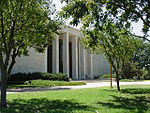
Visit Presidential
Libraries
Presidential Libraries can be found across the country,
from Massachusetts to California
·
museums featuring interactive exhibits
·
interesting and fun public programs
·
important educational events
·
vast archives available for scholarly
research
Presidential Libraries Locations
Herbert Hoover Library - http://www.hoover.archives.gov/

Franklin D. Roosevelt Library - http://www.fdrlibrary.marist.edu/

Harry S. Truman Library - http://www.trumanlibrary.org/

Dwight D. Eisenhower Library - http://www.eisenhower.archives.gov/
John F. Kennedy Library - http://www.jfklibrary.org/

Lyndon B. Johnson Library - http://www.lbjlibrary.org/

Richard Nixon Library - http://www.nixonlibrary.gov/index.php

Gerald R. Ford Library - http://www.fordlibrarymuseum.gov/

Jimmy Carter Library - http://www.jimmycarterlibrary.gov/

Ronald Reagan Library - http://www.reaganlibrary.gov/

George H. W. Bush Library - http://bushlibrary.tamu.edu/

William J. Clinton Library - http://www.clintonlibrary.gov/

George W. Bush Library - http://www.georgewbushlibrary.smu.edu/
Picture not available for G.W. Bush
Recent
The presidential library system is made up of thirteen presidential libraries operated by the
The Richard Nixon Library and Birthplace was not originally part of the presidential library system. While the Nixon Presidential Materials Staff, which administers the Nixon presidential materials under the terms of the Presidential Recordings and Materials Preservation Act, is part of
The Presidential library system formally began in 1939, when President Franklin Delano Roosevelt donated his personal and Presidential papers to the federal government. At the same time, Roosevelt pledged part of his estate at Hyde Park, New York to the
In 1950, Harry S. Truman decided that he, too, would build a library to house his Presidential papers and helped to galvanize congressional action.
The thirteen Presidential Libraries maintain over 400 million pages of textual materials; nearly ten million photographs; over 15 million feet (5,000 km) of motion picture film; nearly 100,000 hours of disc, audiotape, and videotape recordings; and approximately half a million museum objects. These varied holdings make each library a valuable source of information and a center for research on the Presidency.
The most important textual materials in each library are those created by the President and his staff in the course of performing the official duties. Libraries also house numerous objects including family heirlooms, items collected by the President and his family, campaign memorabilia, awards, and the many gifts given to the President by American citizens and foreign dignitaries. These gifts range in type from homemade items to valuable works of art. Curators in Presidential libraries and in other museums throughout the country draw upon these collections for historical exhibits.
Other significant holdings include the personal papers and historical materials donated by individuals associated with the President. These individuals may include Cabinet officials, envoys to foreign governments, political party associates, and the President's family and personal friends. Several libraries have undertaken oral history programs that have produced tape-recorded memoirs. A third body of materials comprises the papers accumulated by the President prior to, and following, his Presidency. Such collections include documents relating to
With the exception of John F. Kennedy, Lyndon B. Johnson, Gerald Ford, and upon their own deaths, Jimmy Carter and George W. Bush, every American president since Hoover is or has chosen to be buried at his presidential library. Kennedy is buried at Arlington National Cemetery; Johnson is buried at his ranch in the hill country of Texas, west of Austin; Carter plans to be buried near his home in Plains, Georgia.[5] George W. Bush has a burial plot in the Texas State Cemetery [6]
Unlike all other Presidents whose libraries are part of the NARA system, Ford's library and museum are geographically separate buildings, located in different parts of Michigan; Ford is buried at his museum in Grand Rapids instead of his library in Ann Arbor.
We hope you'll consider going to some of the libraries, as we have enjoyed the few we've been too so immensely.
Subscribe to:
Posts (Atom)